Ortho ready (L1C)
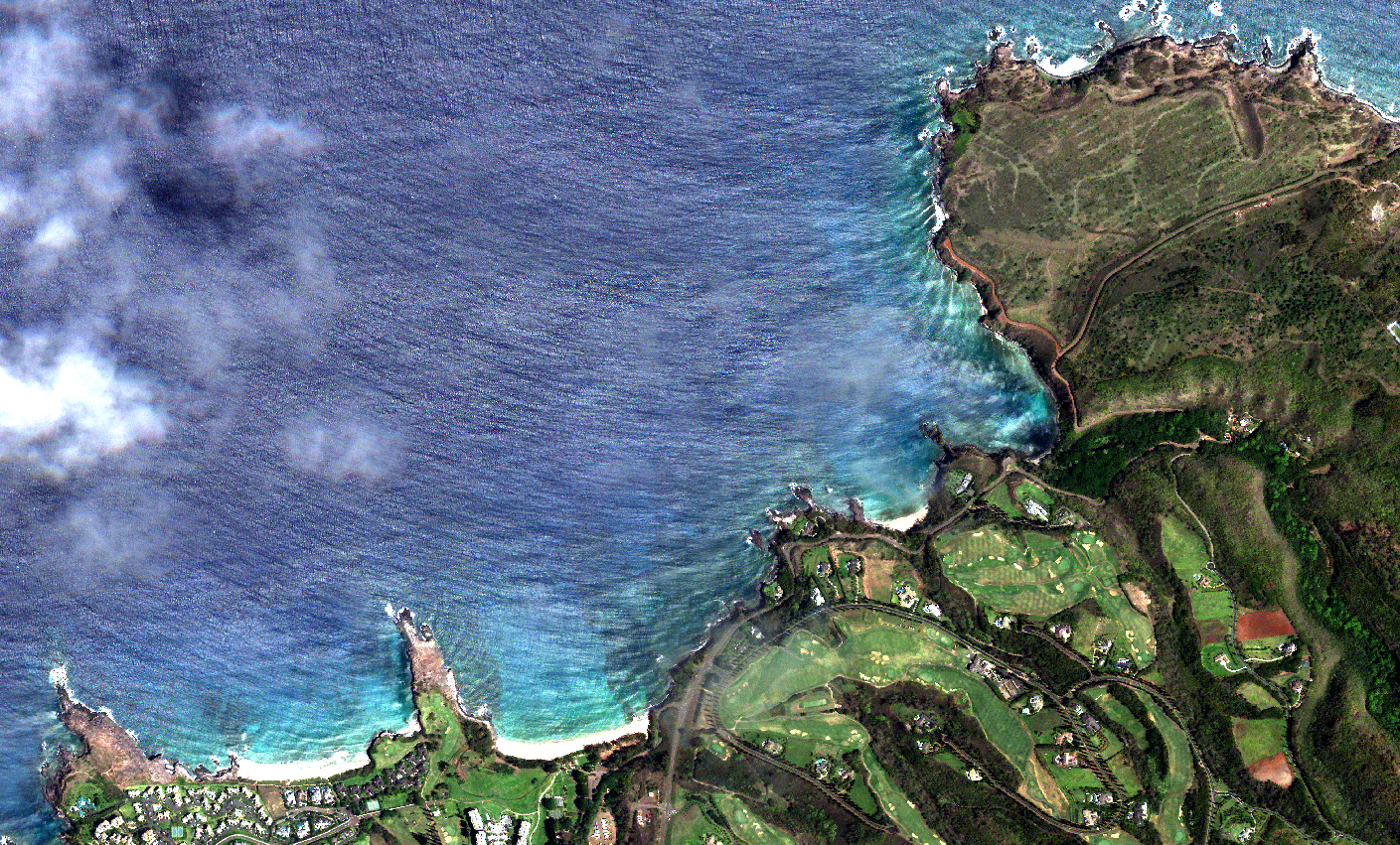
Product description
Ortho Ready, also known as L1C, is a 4-bands imagery product designed for users who want to perform their own orthorectification process with some DEM (Digital Elevation Model) of their choice. The 16 bits, 4-bands (visual and near infra red) rasters are shipped alongside RPCs (Rational Polynomial Coefficients). These two can be combined with a DEM to orthorectify the images and obtain geometrically corrected rasters with a uniform scale.
The main components of this product are the raster and the RPCs. The former comes in GeoTIFF format and the latter comes duplicated both as GeoTIFF tags inside the raster file and as a separate text file with the same base name as the image (for example image.tif and image_rpc.txt). These two RPC formats, inner tags and external text file, are well understood by main GIS software 1. The reason for the duplication is that some software supports one version but not the other one.
The RPCs are obtained after computing Ground Control Points over the images against a reference 2 and performing a bundle block adjustment to minimize the errors and recompute the satellite position and pose. The physical models obtained are transformed and provided as polynomials.
Each raster has a fixed size that depends on the satellite generation, currently available for MarkIV and MarkV. The nominal resolution is also dependant on the satellite generation, the orbit altitude and the off-nadir angle of each capture. For one given scene, several L1C images are provided, where each one of them has some overlap (around 15%) with the following one.
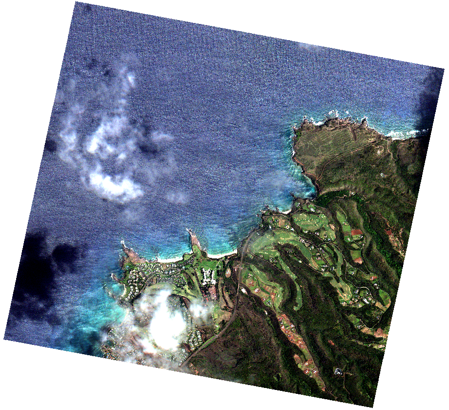 An example MarkIV L1C raster.
Product formation
Ortho ready product level is composed by a collection of anchor frames, these frames are 4-bands stacked images that contain continuous spectral information. With the available spectral and geometrical information the anchor frames or composites are constructed.
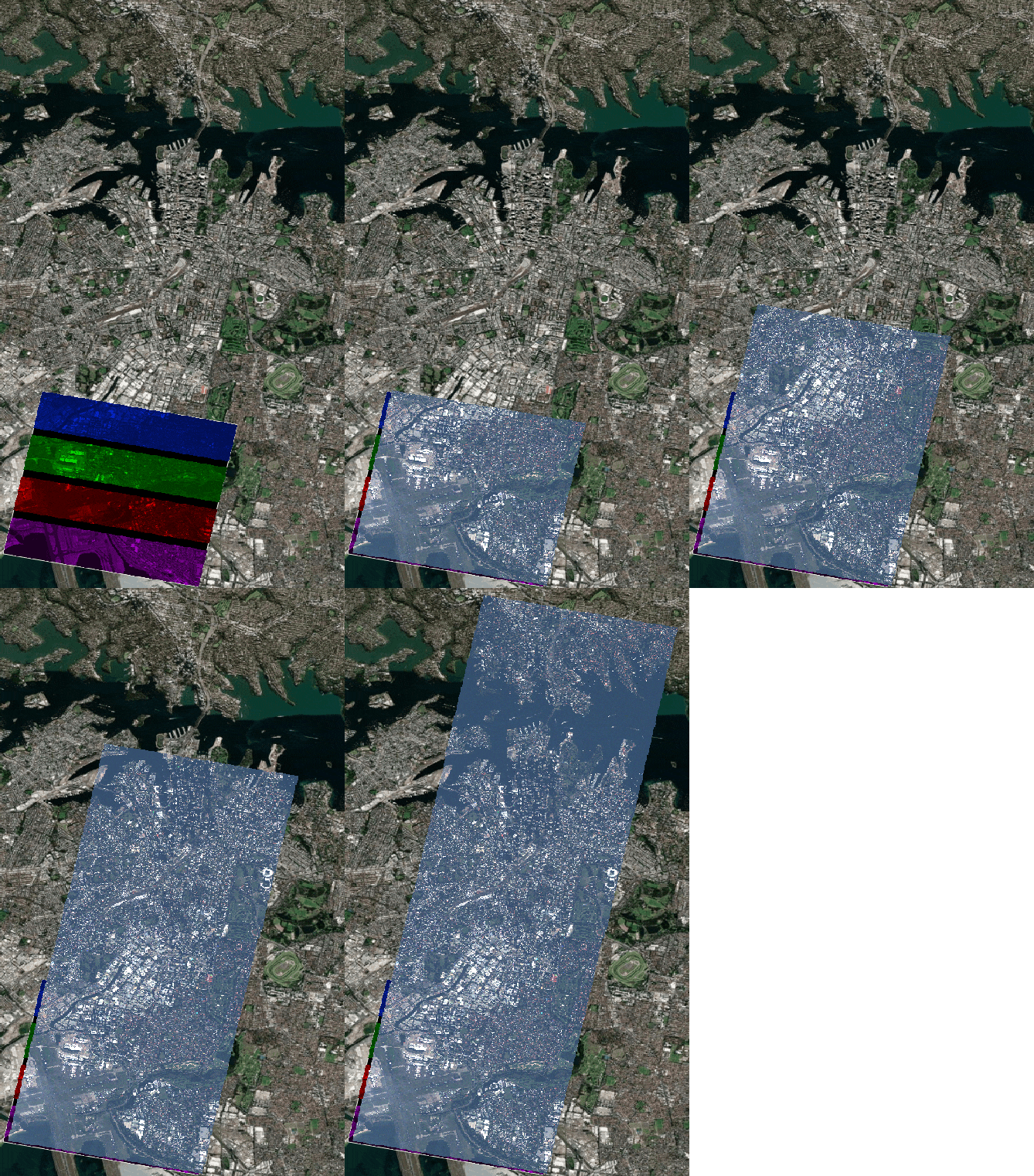 L1C product coverage.
Technical characteristics
| Parameter | Mark IV | Mark V | |
|---|---|---|---|
| Spectral bands | Blue : 450 - 510 nm Green: 510 - 580 nm Red : 590 - 690 nm NIR : 750 - 900 nm |
Blue : 450 - 517 nm Green: 517 - 583 nm Red : 597 - 690 nm NIR : 759 - 890 nm |
|
| GSD | 0.7m - 1.35m 3 | 0.73m - 0.81 3 | |
| Swath @ nadir | 4.8 - 5.5 Km 3 | 6.8Km - 8.5Km 3 | |
| Projection | Geographic coordinates at WGS84 | | |
| Max Off-Nadir angle | ± 25 deg | | |
| Image size | 5120 x 5120 pixels | 9344 x 7000 pixels | |
| Image bit depth | Unsigned integer 16-bit | | |
| Bands | 0: Red 1: Green 2: Blue 3: NIR |
| |
| Band to band alignment | <= 1px ce90 | | |
| Anchor frames overlap | 12% - 22% 3 | | |
| Image format | GeoTIFF, LZW lossless compression | | |
| Ancillary files | RPCs (TXT) and preview (PNG) | | |
Product components
Each L1C product contains multiple assets as well as metadata. All assets follow the same basename template.
{DATE}_{TIME}_{SECOND_DECIMALS}_{PAYLOAD}_{SATELLITE}_{PRODUCT}_{VERSION}_{SUFFIX}.{EXTENSION}
- DATE: Year(4 digits)month(2 digits)day(2 digits)
- TIME: Hour(2 digits)minute(2 digits)second(2 digits)
- SECOND_DECIMALS: All the decimal part from the timestamp seconds
- PAYLOAD: MS for multispectral (4 bands)
- SATELLITE: Satellite name
- PRODUCT: L1C
- VERSION: Check Changelog
- SUFFIX: depends on the asset, might be _RPC, or nothing for example.
- EXTENSION: depends on the asset type.
All time values refer to the capture time in UTC. Hence the string 20220619_153346_938947represent actually 2022-06-19 15:33:46.938947.
Raster
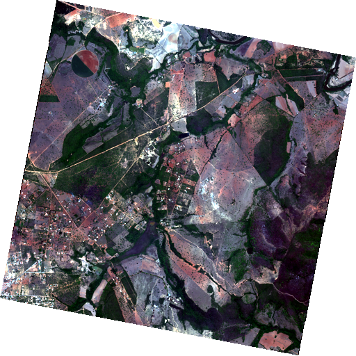 The main raster, also called anchor frame, contains the ready to orthorectify data. It is a fixed size (check Technical specs) 4 bands (RGB and NIR), 16 unsigned bits raster. Its nodata value is 0. Its CRS defined by its RPCs is geographic WGS84. The RPCs are written inside the GeoTIFF as tags 1 and also as a different file in another asset.
The raster format is GeoTIFF with LZW compression.
Example filename: 20220619_153346_938947_MS_NS13_L1C_0_0_0.tif
RPC
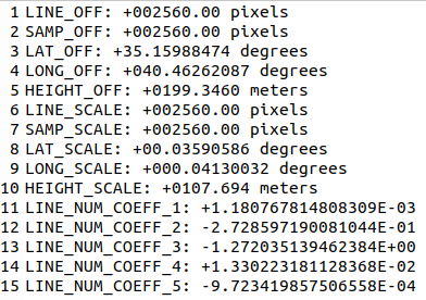 The RPC 4 is a text file with a common base name with the raster plus
 _rpc.txt as suffix. This is a common format to store this information that is understood by most software with orthorectification capabilities.
Preview and thumbnail
 The preview and thumbnail are a reduced version of the raster in 8 bits and png, for visualization and navigation purposes.
Metadata
Metadata is available per anchor frame. Common metadata can be found across composites of the same capture. The following table shows the description of each field and an example corresponding to the image used in previous section.
| Field | Description | Example |
|---|---|---|
| gsd | The approximate ground sampling distance of the image, in meters. | 0.98 |
| datetime | Capture date and time of the item. In UTC | 2023-11-28T11:28:25.279649+00:00 |
| platform | Satellite name that acquired the imagery | newsat13 |
| eo:cloud_cover | The percentage of cloud found on the image, from 0 to 100. | 41.7 |
| view:off_nadir | The off-nadir angle for the capture measured in degrees. | 25.8465 |
| view:sun_elevation | The elevation angle of the sun at the target, at the moment of the capture, in degrees. | 50.4441 |
| view:sun_azimuth | The azimuth angle of the sun at the target with respect to the north | 156.912 |
| satl:outcome_id | A unique identifier of the associated capture with this item. | d5627157-d1aa-472d-9daa-a55086fd32c2 |
| satl:valid_pixel | The percentage of valid pixels on the tile. If less than 100 it means that part of the image contains NO_DATA | 99.457 |
| satl:product_name | Product type | L1C |
| satl:product_version | The version of the product. Uses semantic versioning. | 1.1.0 |
| satl:ba_[B1]_[B2]_ce90 | Circular error at 90th percentile of alignment between bands [B1] and [B2], in pixels | 0.432 |
| satl:ba_[B1]_[B2]_rmse | Radial Root mean square error of alignment between bands [B1] and [B2], in pixels | 0.254 |
| satl:uint16_to_reflectance_[BAND] | The factor to apply to the DN value of every pixel to obtain reflectance units between 0 and 1 . [BAND] can be Red, Green, Blue, NIR. It has a fixed value. | 0.0001 |
| satl:uint16_to_radiance_[BAND] | The factor to apply to the DN value of every pixel to obtain radiance units of W/(m² sr nm) . [BAND] can be Red, Green, Blue, NIR. | 0.0005934402 |
Radiometric corrections
L1C products are built on top of the L1A, which includes the following radiometric corrections.
- Dark signal
- Non-uniformity in pixels response
- Stray light
- Hot and dead pixels
- PSF deconvolution
- Vicarious calibration
Product quality
Band alignment
Given 4 bands (R, G, B, Nir), there are 6 band to band combinations. For each band to band combination, a process based on FFT Phase Matching is run to obtain up to around 2000 matches. There are band combinations that are more difficult to match, like blue and nir due to their spectral difference. With all the matches two different statistics are calculated:
- ce90: The circular error at the 90th percentile. In other words, expect that 90% of the contents of the image have an error below this threshold.
- rmse radial: The Root Mean Square Error gets computed per X and Y dimensions. This value is the norm of that vector.
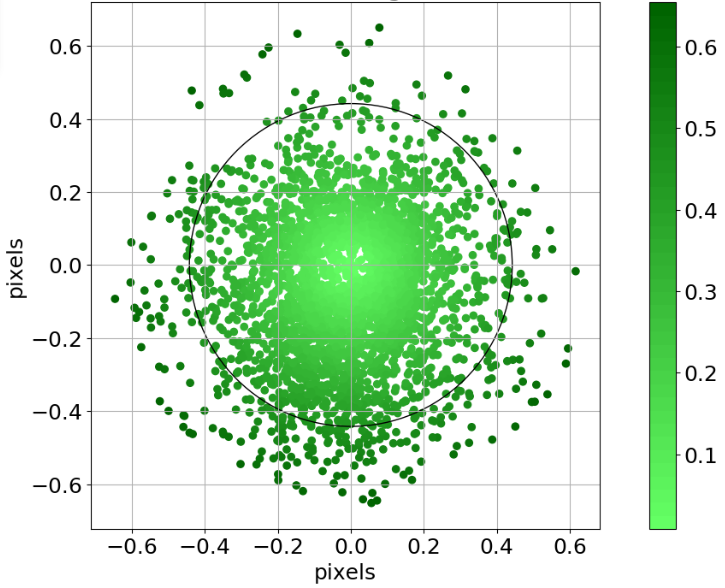 ce90 as a circle over the matches residuals
These two metrics are provided as metadata with each item.
Known Issues of the current version
This section lists product anomalies which sometimes elude the automatic quality assurance criteria, distinguishing those correctable by repeating the image processing steps with different configurations, and those uncorrectable or needing further analysis / pipeline improvements. The most common and best known features are listed in this section. This list may not be exhaustive, but it will be updated in future editions of this document.
Blunders
Anomalies are discerned through a distinctive contrast inversion observed in the NIR band relative to others, with a notable tendency for this irregularity to impact road segments in closer proximity to agricultural fields.
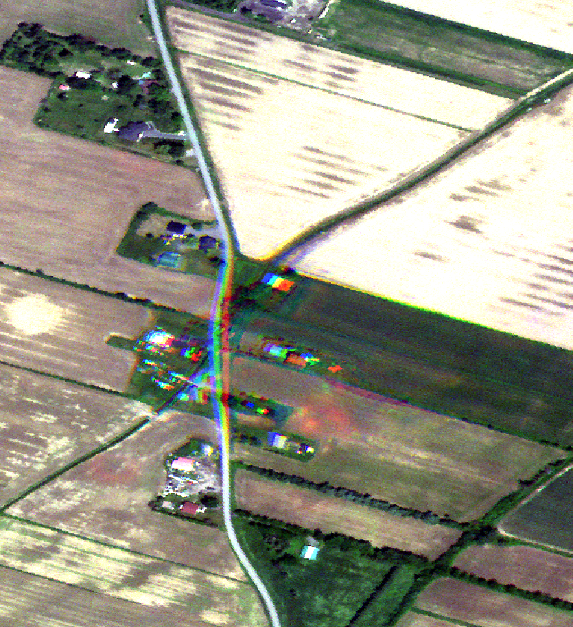 Miss matching effect.
Failure in composition
Eventually the algorithm of composition may fail when creating a composite image. This problem should be isolated respect the surrounding composites, usually due to the need of improving the algorithm with specific image contents. It is expected that this issue will be less likely to be found with upcoming product versions, where the algorithm will progressively get more robust.
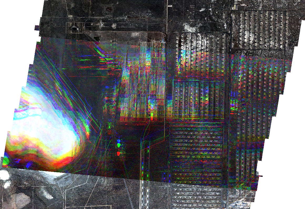 Isolated failure in image composition
Changelog
| Version | Release date | Change log |
|---|---|---|
| 0.10.0 | 15/01/2024 |
|
| 0.9.0 | 15/12/2023 |
|